


Clackamas County (Northwest)--Oregon City, Milwaukie & Happy Valley Cities PUMA, Oregon
About
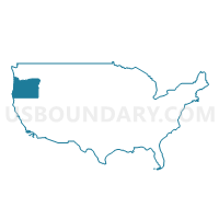
Outline
--Oregon+City%2c+Milwaukie+%26+Happy+Valley+Cities+PUMA%2c+Oregon_A280.png)
Summary
| Unique Area Identifier | 193835 |
| Name | Clackamas County (Northwest)--Oregon City, Milwaukie & Happy Valley Cities PUMA |
| State | Oregon |
| Area (square miles) | 66.38 |
| Land Area (square miles) | 65.00 |
| Water Area (square miles) | 1.38 |
| % of Land Area | 97.92 |
| % of Water Area | 2.08 |
| Latitude of the Internal Point | 45.38762650 |
| Longtitude of the Internal Point | -122.58110850 |
Maps
--Oregon+City%2c+Milwaukie+%26+Happy+Valley+Cities+PUMA in Oregon.png)
Graphs
Select a template below for downloading or customizing gragh for Clackamas County (Northwest)--Oregon City, Milwaukie & Happy Valley Cities PUMA, Oregon
--Oregon+City%2c+Milwaukie+%26+Happy+Valley+Cities+PUMA%2c+Oregon_T0.png)
--Oregon+City%2c+Milwaukie+%26+Happy+Valley+Cities+PUMA%2c+Oregon_T1.png)
--Oregon+City%2c+Milwaukie+%26+Happy+Valley+Cities+PUMA%2c+Oregon_T2.png)
--Oregon+City%2c+Milwaukie+%26+Happy+Valley+Cities+PUMA%2c+Oregon_T3.png)
--Oregon+City%2c+Milwaukie+%26+Happy+Valley+Cities+PUMA%2c+Oregon_T4.png)
--Oregon+City%2c+Milwaukie+%26+Happy+Valley+Cities+PUMA%2c+Oregon_T5.png)
--Oregon+City%2c+Milwaukie+%26+Happy+Valley+Cities+PUMA%2c+Oregon_T6.png)
--Oregon+City%2c+Milwaukie+%26+Happy+Valley+Cities+PUMA%2c+Oregon_T7.png)
--Oregon+City%2c+Milwaukie+%26+Happy+Valley+Cities+PUMA%2c+Oregon.png)
Neighbors
Neighoring Public Use Microdata Area (by Name) Neighboring Public Use Microdata Area on the Map
- Clackamas County (Northwest)--Lake Oswego, West Linn, Wilsonville & Canby Cities PUMA, OR
- Clackamas County (South & East)--Damascus City PUMA, OR
- Multnomah County (East)--Gresham & Troutdale Cities PUMA, OR
- Portland City (Northwest & Southwest) PUMA, OR
- Portland City (Southeast) PUMA, OR
Top 10 Neighboring County (by Population) Neighboring County on the Map
Top 10 Neighboring County Subdivision (by Population) Neighboring County Subdivision on the Map
- Portland East CCD, Multnomah County, OR (462,994)
- Northwest Clackamas CCD, Clackamas County, OR (248,731)
- Portland West CCD, Multnomah County, OR (125,084)
- Canby CCD, Clackamas County, OR (18,361)
- Beavercreek CCD, Clackamas County, OR (7,042)
- Redland CCD, Clackamas County, OR (6,127)
Top 10 Neighboring Place (by Population) Neighboring Place on the Map
- Portland city, OR (583,776)
- Lake Oswego city, OR (36,619)
- Oregon City city, OR (31,859)
- West Linn city, OR (25,109)
- Milwaukie city, OR (20,291)
- Oak Grove CDP, OR (16,629)
- Happy Valley city, OR (13,903)
- Oatfield CDP, OR (13,415)
- Gladstone city, OR (11,497)
- Damascus city, OR (10,539)
Top 10 Neighboring Unified School District (by Population) Neighboring Unified School District on the Map
- Portland School District 1J, OR (459,982)
- North Clackamas School District 12, OR (113,237)
- David Douglas School District 40, OR (63,567)
- Oregon City School District 62, OR (54,748)
- West Linn School District 3J, OR (45,262)
- Centennial School District 28J, OR (41,431)
- Lake Oswego School District 7J, OR (40,616)
- Canby School District 86, OR (30,183)
- Gladstone School District 115, OR (11,022)
- Riverdale School District 51J, OR (2,831)
Top 10 Neighboring State Legislative District Lower Chamber (by Population) Neighboring State Legislative District Lower Chamber on the Map
- State House District 48, OR (76,579)
- State House District 39, OR (65,719)
- State House District 37, OR (63,742)
- State House District 51, OR (62,900)
- State House District 41, OR (59,890)
- State House District 40, OR (59,417)
- State House District 38, OR (58,003)
Top 10 Neighboring State Legislative District Upper Chamber (by Population) Neighboring State Legislative District Upper Chamber on the Map
- State Senate District 24, OR (141,304)
- State Senate District 26, OR (126,141)
- State Senate District 20, OR (125,136)
- State Senate District 19, OR (121,745)
- State Senate District 21, OR (118,917)
Top 10 Neighboring 111th Congressional District (by Population) Neighboring 111th Congressional District on the Map
Top 10 Neighboring Census Tract (by Population) Neighboring Census Tract on the Map
- Census Tract 89.01, Multnomah County, OR (9,415)
- Census Tract 206, Clackamas County, OR (7,814)
- Census Tract 225, Clackamas County, OR (7,756)
- Census Tract 226.05, Clackamas County, OR (7,363)
- Census Tract 3.02, Multnomah County, OR (6,709)
- Census Tract 227.02, Clackamas County, OR (6,685)
- Census Tract 221.01, Clackamas County, OR (6,592)
- Census Tract 232.02, Clackamas County, OR (6,487)
- Census Tract 220, Clackamas County, OR (6,412)
- Census Tract 222.06, Clackamas County, OR (6,412)
Top 10 Neighboring 5-Digit ZIP Code Tabulation Area (by Population) Neighboring 5-Digit ZIP Code Tabulation Area on the Map
- 97045, OR (51,359)
- 97206, OR (47,596)
- 97080, OR (40,888)
- 97202, OR (38,762)
- 97219, OR (38,709)
- 97236, OR (36,852)
- 97222, OR (34,979)
- 97266, OR (33,300)
- 97267, OR (30,839)
- 97068, OR (28,305)